Watersheds/ Rivers and Creeks/ Lakes / Wetlands
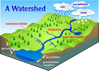
What is a Watershed?A watershed is the area of land where all of the water that is under it or drains off of it goes into the same place. There are three main watersheds in the Arrowsmith/Oceanside Area.
Click the individual links below to find more information Englishman River Watershed and River System French Creek Watershed Little Qualicum Watershed |
|
|
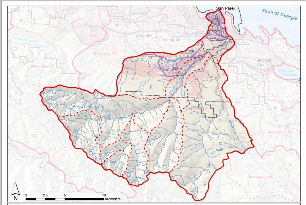
The Englishman River Watershed drains the North -East side of the Arrowsmith range covering an area of 324 sq kilometers.
The Englishman river is the largest river in the area with several tributaries including Morison Creek, Swane Cr. Shelly Cr. And the South Englishman. The largest lakes in the watershed area are: Arrowsmith, Hidden, Fishtail, Rowbotham, Healy, Shelton, and Rhododendron.
|
|
The French Creek Watershed covers 107 square kilometers and drains the north slope of the Rowbotham ridge.
French creek flows from several small tributaries that originate or flow through Errington and Coombs.
|
French Creek Estuary
|

|
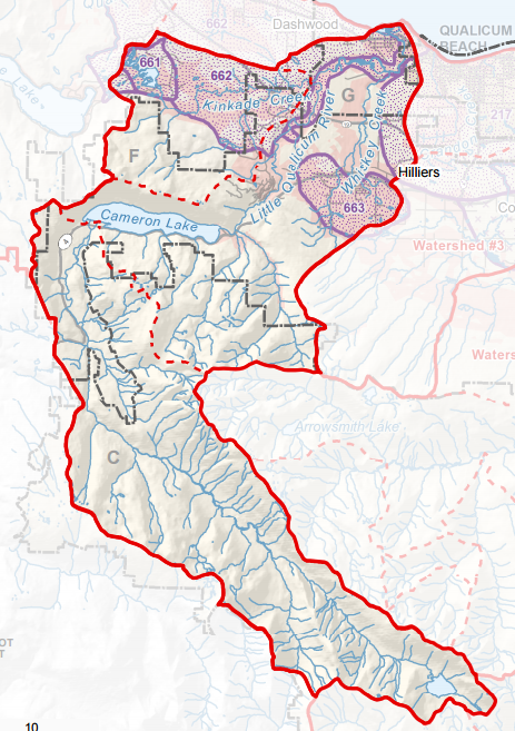
The Little Qualicum Watershed originates from Cameron Lake and Spider Lake covering 235 sq kilometers.
The Little Qualicum River flows from Cameron Lake and is supplied by Kinkade Creeek, and Whiskey Creek. The LQR help to recharge the groundwater for Qualicum Beach’s River well field
|
Several smaller watersheds convey water into the Straight of Georgia.
|
Industry and development combined with the draining of many swamps and wetlands have altered the hydrology in the watersheds.
|
|

Have you ever wanted to build a 3D scale map?
Click the drip to learn how it is done How To Build A 3D Watershed Model https://www.youtube.com/watch?v=nxFqlR_U6lI |
|