R.D.N Electoral Areas F, G, and H
|
What About Water for the People in the RDN?
The Oceanside area is within the Regional District of Nanaimo. The Parksville and Qualicum Beach together have a population of about 21,000. The electoral areas C,E,F,G and part of H have a population about 25,500. A significant number of these people are supplied water from private wells and small water utilities. The RDN supplies water in parts of the Nanoose Bay Peninsula, San Pariel, Englishman River, French Creek, Surfside and Whiskey Creek service areas. A large corporate water utility EPCOR supplies water to more than 4,000 residents generally in area G between Parksville and Qualicum Beach |
|
|
Private wells vary a lot in this area because of the complex topography, geology, and hydrology. Until recent years very few wells were surface sealed and many shallow or abandoned wells transfer surface water directly into the groundwater aquifer. This can result in a large proportion of rural well have a high risk of contamination especially after heavy rain events.
Private well owners are responsible for protecting their wells, pumping, storage and distribution. |

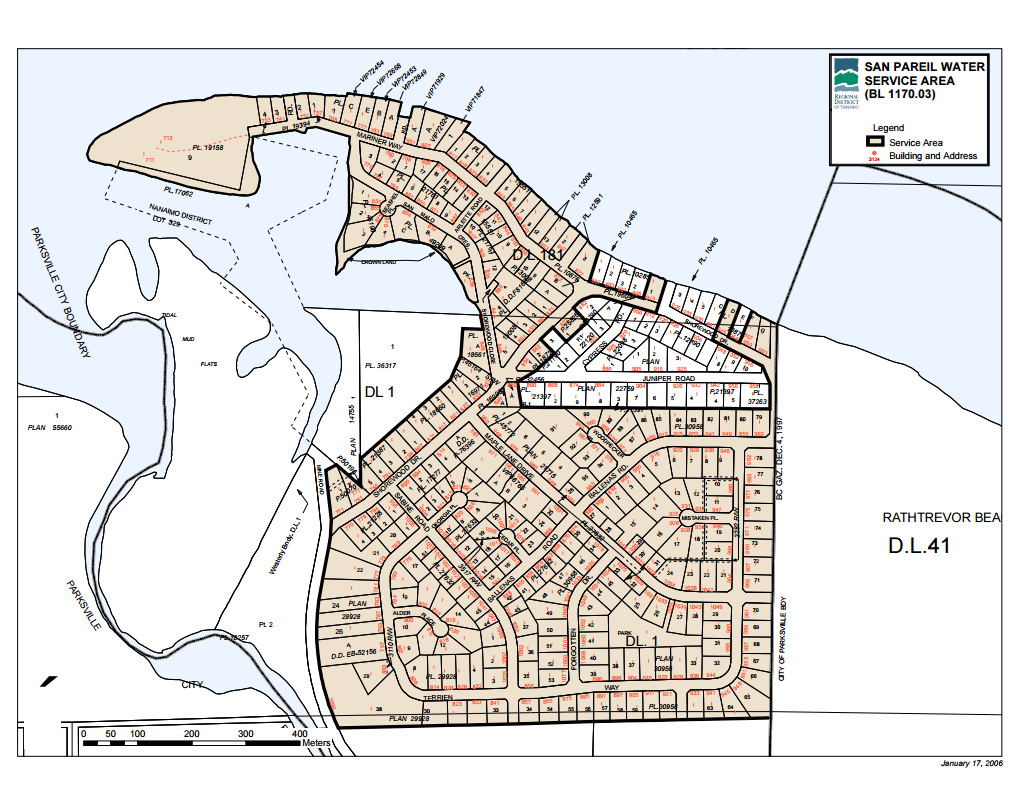
The RDN Service Areas are identified on this drip link
https://www.rdn.bc.ca/electoral-areas This link will take you to information and maps etc. for each of the service areas. The groundwater catchment areas for these systems are not clearly identified. Sources of potential water contamination, are not identified. Some of the water should be considered under the influence of surface water. 
Click the drip to link to the RDN Drinking Water & Watershed Protection program
https://www.rdn.bc.ca/drinking-water-and-watershed-protection |
|
|
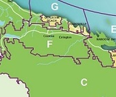
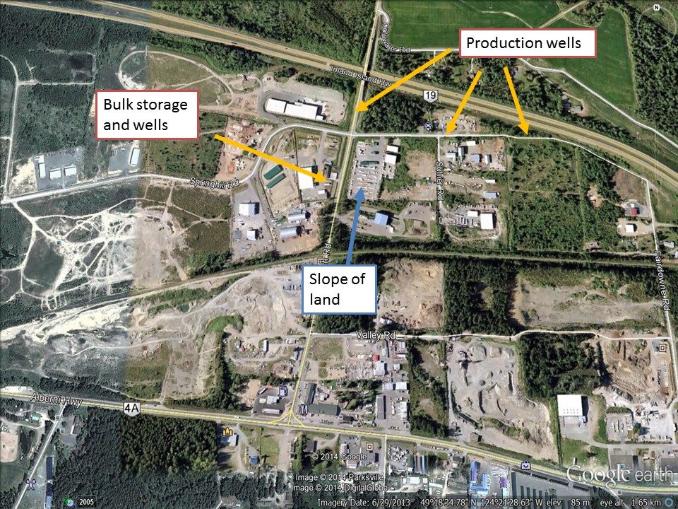
EPCOR is the purveyor of water for 4,000 and increasing population. Well fields are located in the industrial area of Errington near Church Road and Springhill Rd. Other wells are located in the community of French Creek, one is located directly across the road from the sewage treatment plant.

The image on the left shows a part of the drinking water catchment zone for several wells located near Church Road in Errington.
Click the drip link to EPCOR webpages http://www.epcor.com/Pages/home.aspx Click on French Creek service area |